Plane Researching New Madrid Fault
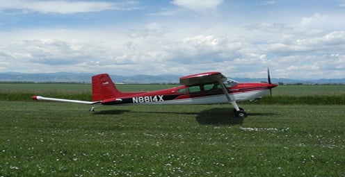
BLYTHEVILLE, Ark. – Geologists take to the skies over the New Madrid Fault to get a better understanding of what is happening below ground. The U.S. Geological Survey hopes the study will help them better understand the cause of earthquakes. “As geologists we believe what happened in the past is going to happen in the future. Trying to understand how earthquakes happen and what they do is important in understanding how to protect others,” said Rick Blakely from the USGS. For the last 40 years, the New Madrid Fault has been the most active seismic zone east of the Rockies. Geologists will use a special device on board that measures the magnetic output from the earth’s surface. “It’s a very sensitive piece of geophysical equipment that measure discreet changes in the earth’s magnetic field the way we produce these surveys is we fly a very precise GPS grid over the ground,” Michael Hobbs, VP of the Airborne Acquisition explains. Over the next few months, scientists will cover more than 1,800 square miles. In order to get an accurate reading they have to fly as close to the ground as possible. “The earthquakes happening on the New Madrid seismic zone are happening on the faults more than one and these faults are not exposed on the surface, we need to figure out a way to look below the surface,” said Blakely. The information will help create a three-dimensional map of the New Madrid Seismic Zone. “This is the first high resolution aero-magnetic survey so this is one piece of the puzzle that geologic scientists did not have in the past this data will be loaded at processed and studied very closely over the next six months,” Hobbs said.