Hotter Tomorrow Before Weekend Starts Wet
[gtxvideo vid=”X42EHxjP” playlist=”” pid=”wMQlYtLM” thumb=”http://player.gtxcel.com/thumbs/X42EHxjP-120.jpg?cachebust=1470369711268″ vtitle=”Weathercast 10.flv”]
Weather Update – 11:00 p.m. Thursday
Skies will become clearer tonight with only a few isolated showers lingering past midnight. However, with light winds and mainly clear skies in place, patchy areas of dense fog could form by morning – especially in parts of West Tennessee that got the most rain today. Temperatures will drop to the lower and middle 70s by sunrise at 6:07 a.m. Friday.
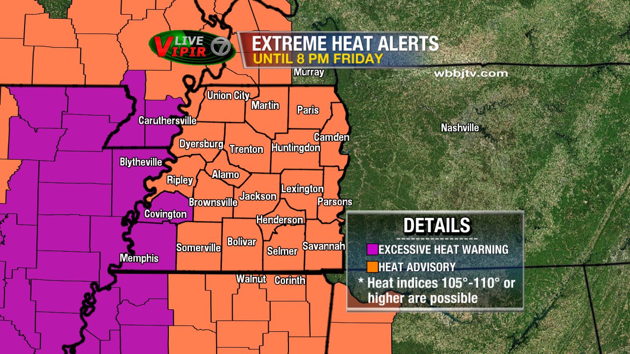
A Heat Advisory is in place for all of West Tennessee until 8 p.m. tomorrow with Excessive Heat Warnings in effect for Tipton and Shelby counties until the same time. A cold front is forecast to bring wet weather this weekend.
FRIDAY
Tomorrow will feature more sun and less scattered storm activity making for a hot day. Highs could reach the middle to upper 90s tomorrow with the heat index getting over 105°F in some areas tomorrow. There’s a slight chance for scattered showers and thunderstorms but not until the afternoon or evening and mainly in northwest Tennessee.
THIS WEEKEND
A cold front will begin to approach northwest Tennessee Friday night bringing showers and thunderstorms to the region for the start of the weekend. Rain could be off-and-on in the Mid-South for much of the morning and afternoon and potentially into the evening as well. Drier weather is forecast for Sunday with temperatures dropping to the 60s during the mornings early next week!
Stay with the VIPIR 7 Storm Team for the latest forecast!
Tom Meiners
Storm Team 7 Chief Meteorologist, CBM
Twitter – @WBBJ7TomMeiners
Facebook – facebook.com/WBBJ.tom.meiners
Email – tmeiners@wbbjtv.com