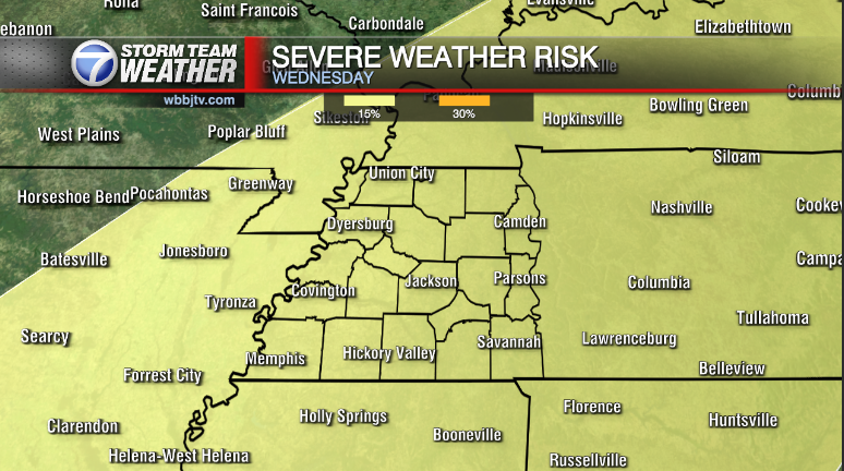
Strong To Severe Storms By Lunchtime
Weather Update Tuesday, October 25 –
An active weather day is expected for us as a vigerous upper level low pressure eject NNE through the Middle Mississippi River Valley this morning. At the surface low pressure will deepen as it transfers from northern Arkansas around Mountain Home, AR to St. Louis Missouri this afternoon. Meanwhile a fairly strong cold front will sweep east towards the Mississippi River through about 2-3 PM before pushing everything eat and out of the region by mid to late afternoon. Ahead of the cold front a line of strong storms is expected to focus up by around 10:00 AM and move quickly eat across west Tennessee. The line will be capable of damaging wind gusts in excess of 60-70 mph. An isolated tornado or two cannot be ruled out.
Storm Team Meteorologist
Moe Shamell
Facebook: www.facebook.com/mshmaellwbbj
Twitter: www.twitter.com/WBBJ7Moe
Instagram: @moeshamell


