Increasing Clouds and Chilly!
Weather Update: Saturday, January 4 —
A very cold and frosty start to the morning today. Polar continental high pressure will continue to dominate the day keeping skies mainly clear initially. temperatures will be slow to respond to the sunshine today. Winds will remain light this morning between 5-10 mph from the east on the southern side of the aforementioned high pressure. Later this afternoon the surface low that will eventually be part of the Winter Storms will begin to strengthen/deepen, which will start to tighten the gradient by this evening. Expect winds to increase to 10-15 mph in response.
Tonight Thru Sunday Morning:
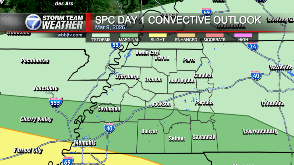
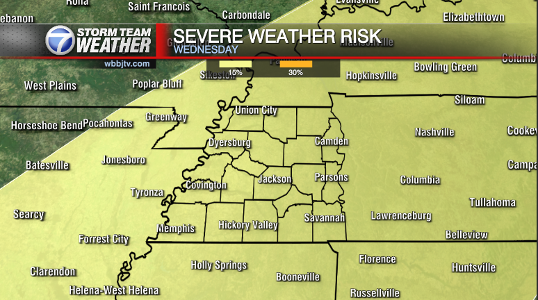
Clouds will start to increase as precipitation shield and associated Winter storm rapidly develops over the South-Central Plans and spreads East towards the Middle Mississippi River Valley. Guidance this morning shows light rain or drizzle developing by 10:00 PM tonight mainly in NW Tennessee. While brief, there is a small window where Futurecast wants to push the 32°F isotherm towards the Kentucky/Tennessee border with the onset precipitation. Regardless, temps will likely push that back north rapidly as the surface low approaches the region, as a new warm sector expands northwards into West Tennessee through morning. Temps will surge into the mid 50s by late morning. There is a Marginal(1/5) threat of strong to severe storms. The main threat will be gusty damaging winds along a rapidly advancing pre-frontal trough by mid afternoon. 

Storm Team Meteorologist
Moe Shamell
Facebook: www.facebook.com/mshamellwbbj
Twitter/X: @WBBJ7Moe
Bluesky: wbbj7moe.bsky.social
Instagram: @moeshamell


