A Cooler But Dry Weekend, Storms Ahead Tuesday Evening
Saturday Morning Update
WBBJ 7 Forecast Update:
A cold front moved through early this morning bringing a cooler weekend as the result. The front is a dry front but will bring an increase in clouds on Saturday. Saturday night will be cool with overnight lows falling down below freezing between 28-30° Sunday morning.

We will warm back up next week but that will set the stage for some severe weather concerns next Tuesday. Tuesday could be a dangerous day, so please have a way to be alerted to any severe weather heading your way and play stay weather aware. Catch the latest details coming up here.

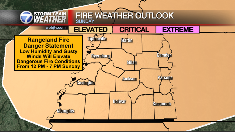
THE WEEKEND:
Overall the weekend is going to be a bit chilly but dry in West Tennessee. Saturday will be warmer than Sunday as another week and mostly dry front will pass by during the day on Saturday. There will be some clouds this weekend but we are expecting mostly sunny skies in general. Highs on Saturday will reach the upper 50s before the front passes and Sunday morning lows will be a bit cool dropping down near freezing for the first time this week. Highs on Sunday will reach the low 50s due to the winds coming back out of the northeast behind the front. Sunday night lows will also be a tad cold as well dropping down somewhere close to 30°, below freezing to start next week.

The next chance for severe weather looks to be in the way for next week. Sometime on Tuesday a powerful system will be moving through. This system looks to be setting up to bring a round of severe weather to the Mid South. We will watch the forecast closely this week and bring you daily updates on the timing of the event as well as who is most likely to be impacted from the storms.

The Storm Prediction Center has already outline an area they are most concerned for the upcoming event which was still 7 days out as of Wednesday. Please stay weather aware as severe seems highly likely from the system as of now, including strong storms in West Tennessee between Tuesday afternoon and Tuesday night!
Brian Davis
Storm Team 7 Meteorologist
![]()
Twitter – @Brian7wbbj
Facebook – Briandaviswbbj
Email – Badavis@wbbjtv.com