High Flood Risk (4/4) & Moderate Severe Storm Threat (4/5) on Wednesday!
WBBJ 7 Forecast Update
WBBJ 7 Forecast Update:
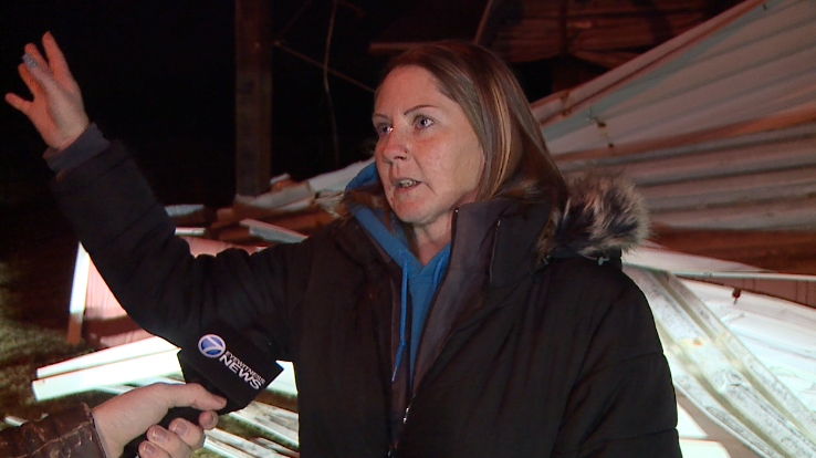
It was a very active Wednesday across the Mid South. Over 225 tornado warning were issued with many confirmed tornadoes. We will get a total of confirmed tornadoes from the National Weather Service in Memphis as they conduct their surveys later this. So far, they have confirmed a preliminary damage of EF-3 in Selmer. More storms are expected tonight, Friday and Saturday as well.

Thunderstorms have sparked up and will become stronger as we get going into the evening hours. On top of the severe storm threat, significant flooding is occurring and will continue through Saturday. Another 6-10″ of rain will be possible in some areas over the next 60 hours. Please stay weather aware tonight, monitor weather alerts for tornadoes or extreme flash flooding. Stay weather aware folks and do not let you guard down yet!

This is a difficult forecast, depending on where the line sets up, you could see over 10″ of rain or less than an inch. The most likely areas for significant flooding will be along I-40 with the highest chances northwest of Gibson county. On top of the flood threat, severe weather including supercells are expected Wednesday after 4pm. Supercells are the most difficult storms to forecast exactly when and where they are going to pop in the instability zone. Any supercells that develop will likely produce tornadoes given the conditions and storm parameters that will be set up across West Tennessee Wednesday evening. According to the NWS in Memphis: GENERATIONAL FLOODING is anticipated this week as a cold front stalls over the I-40 corridor!!!

THIS WEEK:
After a stormy day on Sunday, things quieted down on our Monday and will remain quiet until Wednesday afternoon across West Tennessee. Starting Wednesday, the weather is going to take a turn for the worse and stay rough through the weekend. A flood watch is out, an moderate risk for severe weather on Wednesday, and more severe weather concerns on Thursday, Friday and Saturday as well. Please stay weather aware and monitor forecast information as it becomes available this week.

On top of the severe storm threat, a major concern for flooding will start Wednesday night and last through the week into the weekend. Several rounds of storms and heavy rain is forecast from Wednesday evening through Saturday night and could last into Sunday morning. Some areas are expected to see over 10″ of rain during that time frame. Flash flooding as well as river flooding seems highly likely at this time around the region.

Thunderstorms will continue Thursday along a stalled out boundary that will remain stationary for a few days. More storms and heavy rain is expected off and on Thursday night into Friday morning. Highs on Thursday and Friday will make it up around 80° and both nights overnight lows will fall to the mid 60s. If we get the sun to peak out on Saturday, we could reach the low to mid 80s that might fuel another round of severe weather. The winds will come out of the south until Sunday and then we are expecting mostly cloudy skies through the weekend as well.

THE WEEKEND:
Rain and storms are expected on Saturday and probably some severe weather. By Saturday, ground in West Tennessee will be extremely saturated and many rivers, creeks and streams will be running high. Any additional rainfall over the weekend will increase the flood threat across West Tennessee. The rain is expected to finally move out during the day on Sunday. As the front passes Saturday night, Sunday morning lows will fall into the mid 50s. Highs on Sunday will struggle to even hit 60°. Sunday night will be cool and we could see a frost Monday morning with morning lows expected to fall down to the mid 30s as of now to kick off next week. The sun may try to come out Sunday afternoon but we should see mostly sunny skies next Monday. The winds will change from the south on Saturday, to the west on Sunday and back to the northwest by Monday.

Storm Team Chief Meteorologist
Joel Barnes
Facebook: @JoelBarnesWeather
Twitter: @JoelBarnes13
Instagram: @joelbarnes13