More Rounds Of Severe Weather, Flooding Threat Grows
AM Thursday
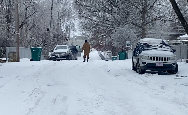
Multiple supercell and tornadic storms rolled through the west Tennessee area on Wednesday night with Catastrophic damage in the Selmer area. Homes were destroyed and cars flipped upside down along the road for what looked like winds on the EF-3 scale which is a powerful tornado.

Powerlines were and power poles were snapped and power was still off into the late morning hours of Thursday. More damage was reported with a tornado in Parkers Crossroads with the City hall being damaged. There is likely lots of other damage paths but some were more in rural areas.

Large hail was reported in Martin, Parkers Crossroads, Selmer, Buena Vista, and many other areas of west Tennessee overnight with some hail close to egg and tennis ball size.

As the system that brought the severe weather stalls out over the area, we can expect more rounds of severe weather again over the next few days. In fact, At least some form of severe risk is with us each day through Saturday before the system slowly winds down by around Sunday morning.

Catastrophic flooding will become a big risk, especially along and north of I-40 as we continue with several days of heavy rain and upwards of 10 inches or more is in the forecast in areas that already struggle with flooding. Although we saw our highest risk of tornadoes on Wednesday with the 5 out of level 5, We are still looking at a serious risk of severe weather to return in the late afternoon through the overnight hours tonight. This evening we’ll be in the 3 out of 5 risk over most of the west Tennessee area with Supercells likely developing again.
Radar will continue to show rain and storms on and off through at least Saturday with the system finally winding down around Sunday of this week.
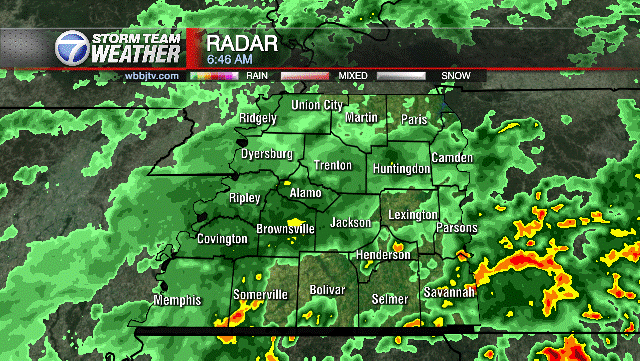
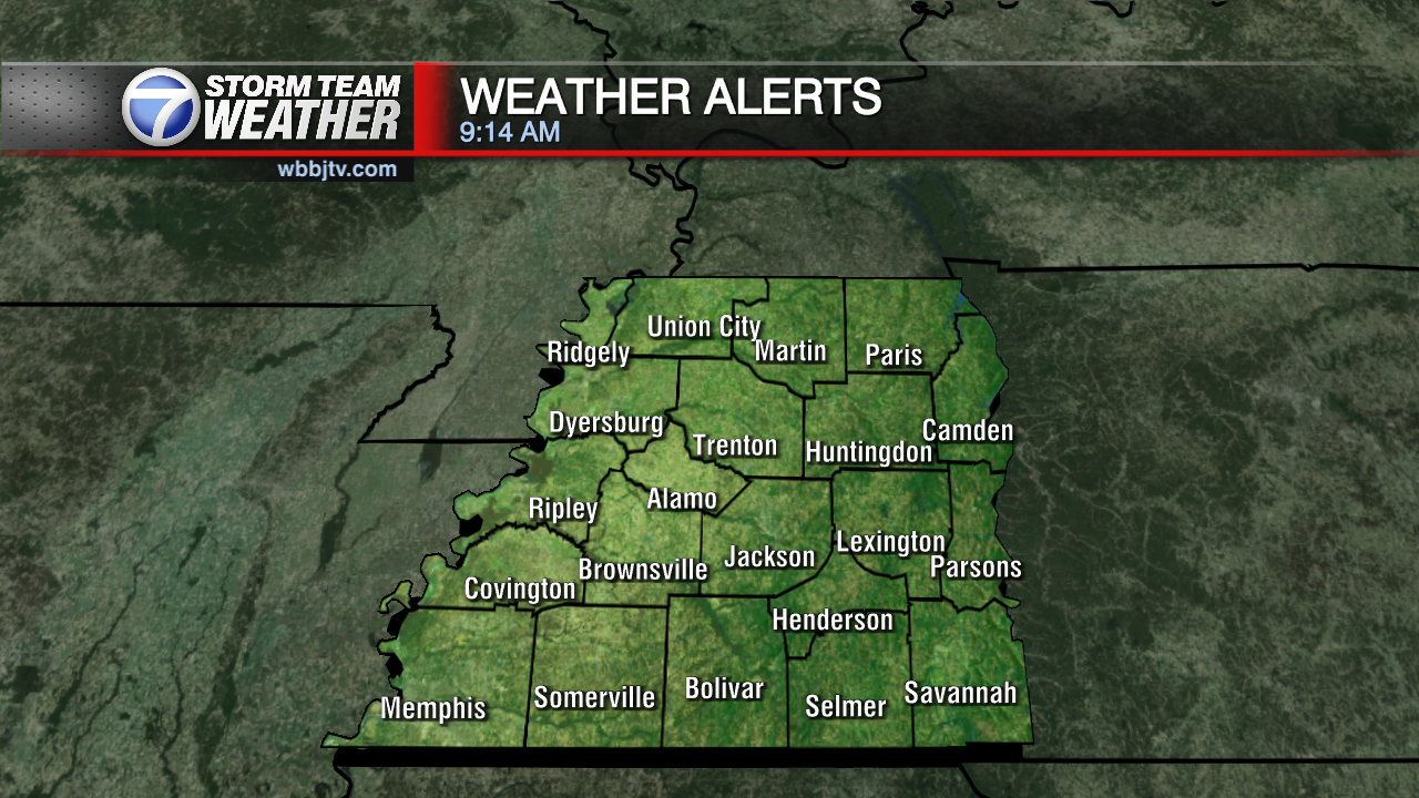
We’ll continue to have flood warnings along with severe storm warnings, especially in the late afternoon and evening hours and again overnight. Unfortunately, The tornado threat is going to be a problem again along with the large hail threat, so continue to stay weather aware over the next few days as each day will have at least some level of severe threat with it. Here is a look at any warnings issued below.
Severe weather will continue over the next few days and the tornado threat looks quite high again this evening and tonight so stay with the WBBJ 7 Eyewitness Weather Team for the latest on watches and warnings in your area.
Brian Davis
Storm Team 7 Meteorologist
![]()
Twitter – @Brian7wbbj
Facebook – Briandaviswbbj
Email – Badavis@wbbjtv.com