Some Nice Weather To Start Our Weekend
Friday Morning Update
WBBJ 7 Forecast Update:
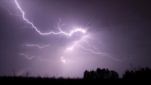
Yesterday was a busy day in the weather center as numerous strong storms and a few severe storms moved through the west Tennessee area producing large hail in the afternoon and early evening hours. Hail ranged in size from near Golf Ball to Ping Pong to Dime and Nickle sized in the area.

The weather is much more quiet into our Friday ahead….
By the way, it is going to be another foggy night for many areas in West Tennessee, but the forecast isn’t all bad. Great news if you were hoping for some decent weather for the Grand Parade today or over the weekend to enjoy the fun at the Strawberry Festival in Humboldt. The weather looks dry with a mix of sun and clouds on Friday and Saturday. Also, chances for rain on Sunday are only 30% at this time. There will be a low pressure system passing to the south of us but it looks like it is just going to bring some clouds for most of us. There will be some showers early next week and a shot to get close to 90° next week and we will tell you all about it right here.

THIS WEEK:
We saw a few rounds of showers and storms on Thursday with some in the late morning with the most of the them popping in the afternoon and early evening hours. The storms will taper off later tonight as the front comes by and we are not expecting a threat for severe weather after the sun goes down. A few weak storms will be possible as the front coming through later this evening into the night time hours. Highs on Thursday reached the upper 70s to around 80° for most of us. We saw partly to mostly cloudy skies and it was a bit humid during the day as well fueling those afternoon storms. The winds came out of the west and were light for most of the day unless you got caught in one of those storms. Thursday night lows will again fall down to the mid to upper 50s and we should be mostly dry tonight with calm winds.

A weak front will passed by Thursday night into Friday morning but that will keep pretty much all of us dry on Friday. There could be a few showers early Friday morning before the sun comes up, but overall we are expecting a dry day and dry weather for the main parade on Friday morning in Humboldt. Chances for rain on Friday are less than 10% so they cannot be ruled out but we are not expecting much at all. We will see partly cloudy skies on Friday with a light breeze coming out of the northeast behind the front. Highs on Friday will reach the mid 70s again and Friday night lows will be a bit cooler with less clouds as we head into the weekend. We will kick off our Saturday in the mid 50s and it looks like a pretty mild weekend for most of us.

THE WEEKEND:
There is going to be another stalled out low pressure system this weekend, but unlike last weekend, this one is likely going to set up to the south of us. This will keep a few showers chances around with most of them being in our southern counties next to the Mississippi border. If the system drifts a bit further north than we are currently thinking we could see a few weekend showers as well. But as of now, chances for rain on Saturday are 20% late and Sunday is 30% during the day. Severe weather or strong storms are NOT in the forecast this weekend. We should see partly cloudy skies this weekend too with more clouds being down south than up north.

The winds this weekend will vary in direction around the low but will most likely come out of the northeast on Saturday and out of the east on Sunday. The easterly winds will keep temperatures below 80° for all of us. Highs on Saturday are forecast in the low to mid 70s and Sunday in the mid to upper 70s. Morning lows this weekend will stick around in the low to mid 50s. We should warm up a bit as we kick off next week as well. There is a chance we reach the upper 80s and back up to near 90° in the middle of next week!
Brian Davis
Storm Team 7 Meteorologist
Twitter – @Brian7wbbj
Facebook – Briandaviswbbj
Email – Badavis@wbbjtv.com