Cold Front To Bring A Taste Of Fall
WBBJ 7 Forecast Update
Temperatures will be falling to a very comfortable range after a cold front pushed through earlier this afternoon. The week ahead looks dry with only one chance for some scattered showers over the next 7 days.
Cold Front:

The airmass originated from Hudson Bay, Canada. Originally it was a humid airmass, but as it moved over the Canadian prairie and American plains, the air dried out quickly. This cold front will knock temperatures down to the upper 70s for many days this week, and we’ll have a chance at breaking some record lows this week.
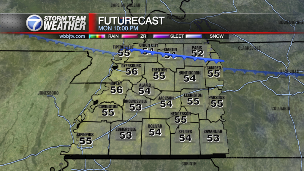
Monday:
Temperatures will be struggling to crack the 80s much of the first half of the week. There will be increasing cloud cover over the course of the afternoon, but a rather uneventful start to the week here in West Tennessee
Tuesday and Wednesday:
Like Monday, Tuesday will be rather uneventful, but we do have a chance at breaking our record low Tuesday night and Wednesday night. The record right now is 54 degrees. Many areas in the Mid-South will fall into the mid-50s, so we’ll be watching thermometers region-wide all night long.

Thursday:
As of Sunday afternoon, Thursday looks to have about a 30 percent chance of showers across West Tennessee. Not much more can be said about these August showers even though the area will not have the available energy we would normally have this time of year.
Friday:
Friday will be warmer but still fairly dry. Temps will begin to climb back into the mid-80s, but the weather should still be wonderful for Week 2 of Football Friday Night here at WBBJ. Expect temperatures to be in the upper 70s at kickoff and to fall into the upper 60s by game’s end.