Mostly Dry Weekend, Rain And Storms Next Week…
Saturday Morning Update
WBBJ 7 Forecast Update:
Other than a slight rain chance late tonight, the weekend is looking dry. Today will be our warmer day between the two with highs topping out in the upper 70s. We’ll have breezy winds from the southwest 10-15 mph and tonight will feature a slight chance of showers as a weak cold front blows through. We’ll return to another dry with cooler temperatures on Sunday as highs top out in the upper 60s.

Saturday night lows will fall down to the upper 50s but we will fall to the mid 40s on Sunday night. Expect a mix of sun and clouds this weekend. There will be better chances for rain early next week as a low pressure system looks on track to move through. Some storms could be returning early next week as well.

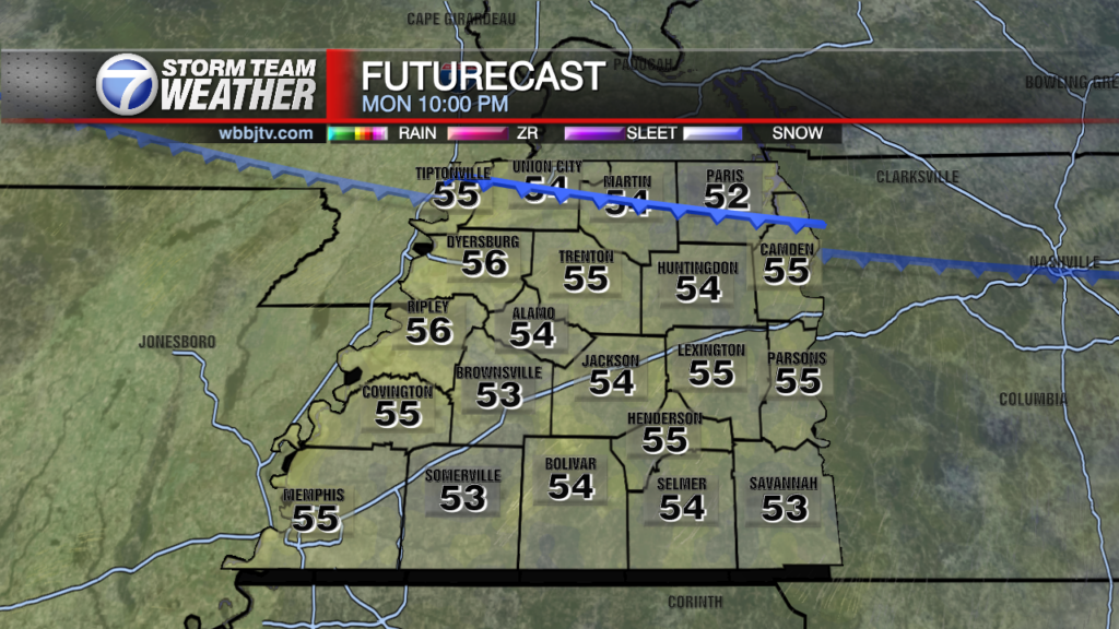
NEXT WEEK:
Rain chances will return on Monday next week and be sticking around each day during the work week. Storm chances will also be increasing into the middle of the week as a severe storm setup will return to the Mid South. The timing and severity of the event has yet to be determined as well as who in our area will most likely be impacted. Highs next week will linger around 70° with morning lows sticking around into the mid 50s for the most part. The winds will have a southerly component to them during the work week and expect a mix of sun and clouds as well. As of now, the greatest threat for severe weather looks to be coming sometime on Thursday or Friday in our area. We will keep a close eye on the potential for severe weather as the week goes on in the 7 Storm Team Weather Center.

Storm Team Meteorologist
Brian Davis
Storm Team 7 Meteorologist
Twitter – @Brian7wbbj
Facebook – Briandaviswbbj
Email – Badavis@wbbjtv.com