Record Warm Temps Likely This Weekend!
Weather Update: Friday, March 20 —

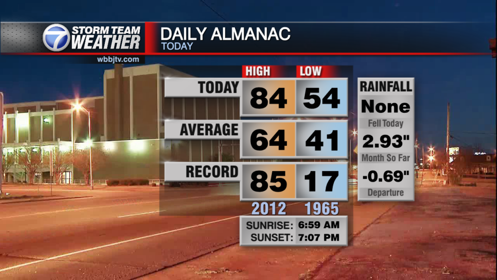
Good Afternoon and welcome to Spring 2026. It officially began this morning during the Vernal Equinox at 9:46 AM CDT. This is when the Sun’s most direct rays cross the Equatorial Plain from the Southern Hemisphere back into the Northern Hemisphere. The sun angle from today through June 21 at 3:24 AM CDT ( Summer Solstice) will climb in the sky. having said all that, it actually has nothing to do with the record heat we have on tap for the upcoming weekend. The responsible party for that is an early season strong ridge which is meandering around SW Arizona. the far eastern periphery of that ridge will be brushing up and into the Midsouth this weekend allowing temps to climb well into the 80s.

Late Sunday into Monday:
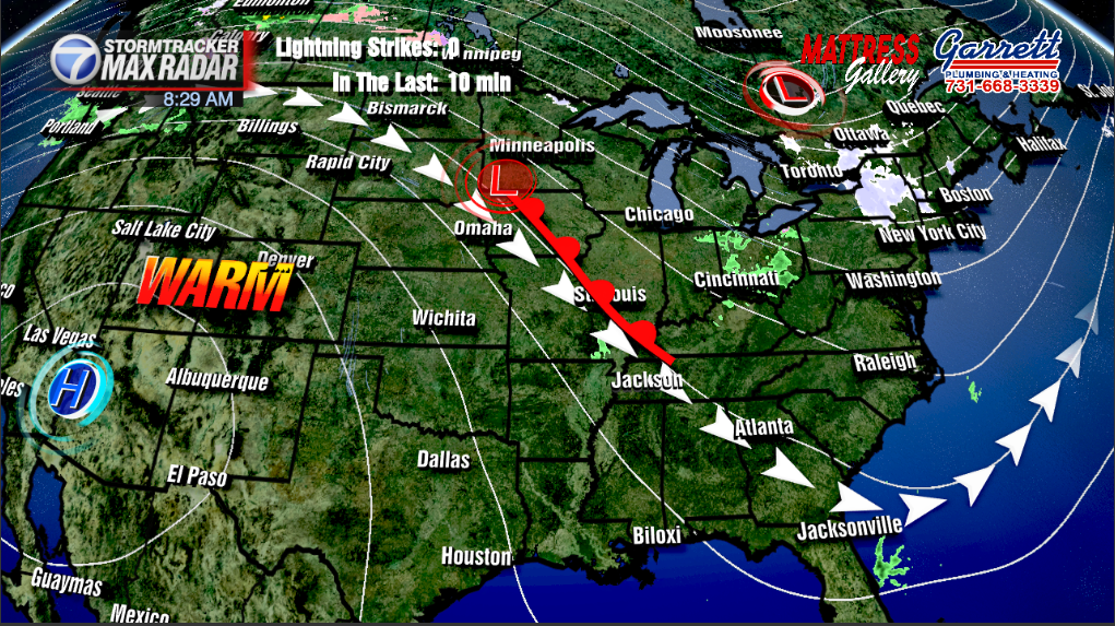
We’ll remain in the ridge most of the weekend, however on the ridge’s NE side within NW flow aloft a cold front will be sneaking by from the Northern Plains over into the Ohio Valley. That cold front will impinge on the ridge weakening it enough to drop temps back into the mid 60s for highs early next week. There won’t be much moisture to work with locally given the ongoing drought and blocking ridge. There may be enough residual moisture from the maritime front that clouds and perhaps a few spotty showers will be possible as close as the Western Kentucky Parkway Monday morning. For now, the forecast is dry locally, but its something to watch over the weekend.
Storm Team Meteorologist
Moe Shamell
Facebook: www.facebook.com/mshamellwbbj
Twitter/X: @WBBJ7Moe
Instagram: @moeshamell