Spring-Like Temps Return For Now
Weather Update: Monday, March 23 —

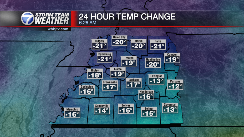
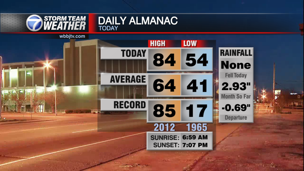
Good Morning West Tennessee. After a record setting and breaking weekend. A much cooler and more seasonable day is on the way. Temperatures this morning are starting of 17 to 21 degrees colder than Sunday morning. Its accompanied by an area of continental polar high pressure. The pressure difference will be the reason for the persistent northerly wind 10-15 mph. There is a wind chill today, it will feel more like the mid to upper 40s to low 50s even at the warmest point of the day. High around 63°F.


Tonight and Tuesday:
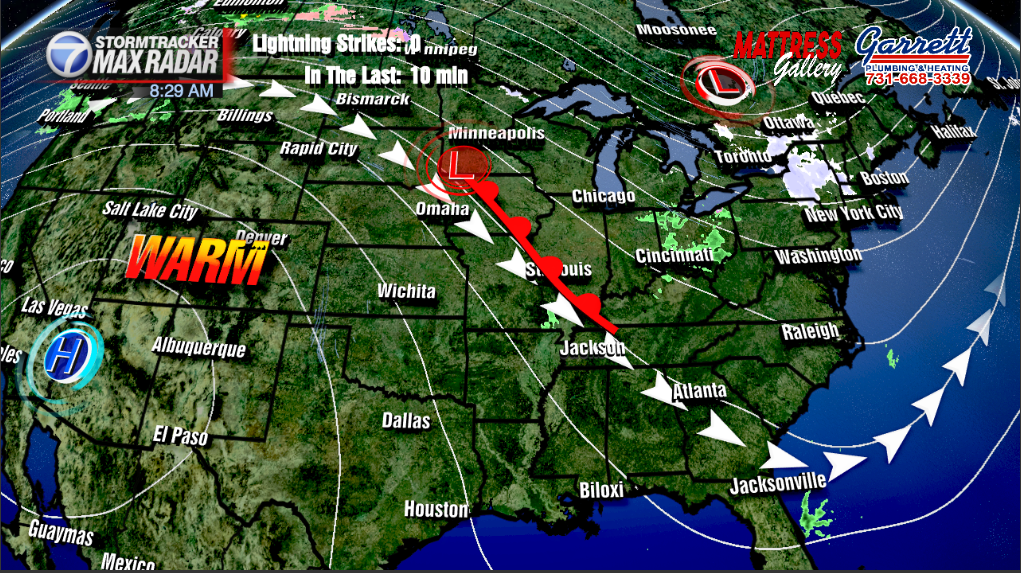
Clouds will increase towards this evening, though no precipitation will result from it. The heat bubble responsible for the record-breaking weekend will wobble back east into the Midsouth. It will take until Thursday, but there will be a noticeable slow warming trend until that point.
Storm Team Meteorologist
Moe Shamell
Facebook: www.facebook.com/mshamellwbbj
Twitter/X: @WBBJ7Moe
Instagram: @moeshamell