Rain showers and weak storms expected to return on Saturday.
Friday Night Forecast Update
Good Saturday Everyone On This January The 30th:
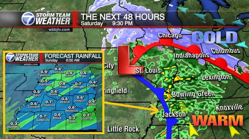
A few showers early before a break in the rain midday. Thunderstorms return mainly after 5 pm this evening with some heavy rain at times. We will likely start with a pretty sunrise on Sunday morning before a 20% chance of showers in the afternoon. In comes the colder air late day and some models are hinting at some snow flurries on the back side of the storm system Sunday night, but accumulations are not expected. It will be a cold start to next week. Catch the latest details and your full weather forecast coming up right here.
TODAY:
Showers in the morning mainly through 9 am with a return of showers and thunderstorms returning again after 5 pm. Highs in the upper 50’s.
TONIGHT
Rain showers and possibly some very weak thunderstorms are expected in the evening and overnight hours, mainly before midnight, a low of 50. Severe weather is currently highly unlikely. Sunday will bring a dry start the first half of the day before. A few scattered showers in the afternoon followed by scattered snow flurries in the evening, Highs will top out around 52 with lows Sunday night around 33.

Storms will be moving in throughout the evening and winding down before midnight,

MONDAY/TUESDAY:
Some models are showing some early morning flurries on Monday before the sun comes up on the back side of the storm system. If you don’t see any snow, it will still be pretty cold behind the weekends storm system. Highs will only make it into the low to mid 40s and overnight lows in the low 30s or upper 20s.

WEDNESDAY/THURSDAY:
The next storm system will show up late Wednesday and will bring more rain showers with it. Thunderstorms could develop depending on the timing of the storm system so we will track it closely next week. Highs should reach back into the 50s both days.
Brian Davis
Storm Team 7 Meteorologist
Twitter – @Brian7wbbj
Facebook – Briandaviswbbj
Email – Badavis@wbbjtv.com


