Rain Saturday Evening, Late Snow Chance, Next Week Could be a Mess!
Friday Night Forecast Update
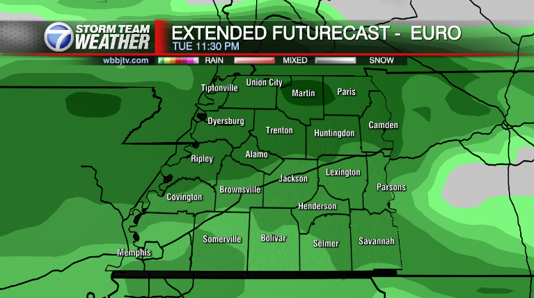
Friday Night Forecast for February 5th:

Clouds will continue to move in tonight and rain is expected to return Saturday afternoon. Light snow could mix in with the rain overnight into Sunday morning as some cooler air will push in. Two different storm systems will be converging over our area Saturday night making for a tricky forecast.
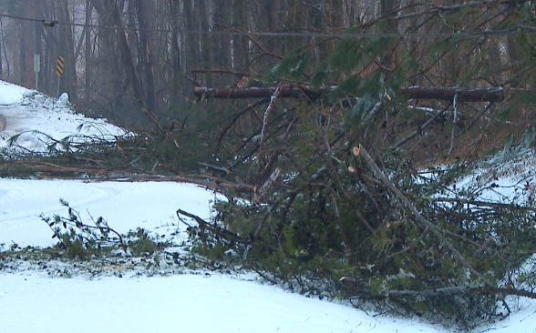
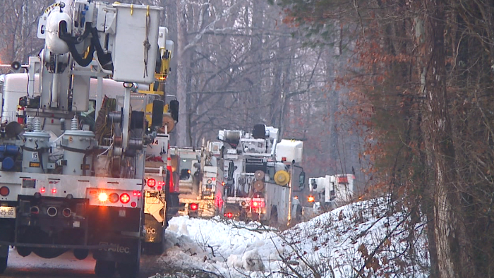
Monday looks pretty nice, but towards the middle and end to next week, a major winter blast is expected to move into West Tennessee. Freezing rain, sleet, ice and snow could move in with lows dropping into the single digits by the end of the week. Catch the latest update and full weather forecast right here.
TONIGHT:
It will remain very nice tonight, clouds will move on it through overnight with lows dropping into the low to mid 30s. Winds will be calm most of the night. The next storm system will approach on Saturday.

THE WEEKEND:
A few snow flurries could show up Saturday night into the day on Sunday as the next storm system will move through the area. Snow accumulations are not currently expected. Highs will make it up to around 50° on Saturday before the first of two systems moves in. Expect cloudy skies for most of the day on Saturday.

Sunday morning lows will dip into the mid 20s for most of us and Sunday highs are expected to reach the low 40s. Sunday night lows will again drop into the 20s before we start the work week.

NEXT WEEK:
It could be a mild to start next week, especially Monday when highs are expected to be back in the mid 50s. The timing and strength of the next few storm systems is under scrutiny right now. Some models have it coming in Monday night and some not until Tuesday night. As the front comes by we are expecting rain to start and possibly turning over to ice or snow, but that all depends on what time the front passes by.
We are expecting very chilly arctic air behind the front when it does pass by. Expect highs in the 20s and lows in the teens toward the middle and end of next week. Some of the models are hinting at a winter mess coming in Thursday and Friday including ice and snow accumulations. Some models are even hinting at temperatures down near 0° next Saturday morning. Forecast models are not super reliable 6-8 days out, so lets hope the forecast changes before the end of next week. We will keep a close eye on the tricky forecast for next week here in the WBBJ Storm Team Weather Center.
Storm Team Chief Meteorologist
Joel Barnes
Facebook: www.facebook.com/joelbarnesweather
Twitter: www.twitter.com/joelbarnes13
Instagram: @joelbarnes13