Storms Expected to Continue Wednesday Night, Severe Threat Seems Low
Wednesday Night Forecast Update
Wednesday Night Forecast for March 17th:
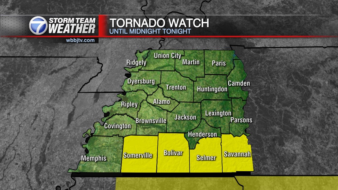
Looks like most of West Tennessee avoided any severe weather from this evening storms. Unfortunately the folks in Alabama and Mississippi took the bulk of the damage this go around. We will still do updates every 30 mins on WBBJ TV programming tonight and will continue to track that storms as long as they still pose a threat to us. A tornado watch remains in effect until Midnight for Fayette, Hardeman, McNairy and Hardin counties.
TONIGHT:
Storms are expected to hang around until around midnight. Some severe weather including the threat for tornadoes will continue to be a concern south of I-40 so be sure to stay weather aware tonight. The threat is minimal though so don’t expect to see anything to intense. After the showers clear out temperatures will drop down to around 50°. Winds will stay breezy at of the south.
THURSDAY:
Thunderstorms will clear out by Thursday morning but mostly cloudy skies will still be sticking around. A few lingering showers will be possible on the back side of the storm system. Rainfall amounts should remain low if you see any rain at all. Highs will drop into the mid 50s and overnight lows will drop into the mid 40s. It is expected to be breezy at times with the winds coming in out of the west.
FRIDAY:
Mostly cloudy skies will stick around for Friday. Winds will be breezy at times and come out of the northwest. Highs will only reach the mid 50 and overnight lows will drop down to around 40°.
THE WEEKEND:
As of now the weekend looks pretty nice. Highs will make it into the 60s and plenty of sunshine is expected. Winds will start out of the northeast on Saturday and turn to the southeast by Sunday afternoon. The first day of spring is officially on Saturday.
NEXT WEEK:
Monday will remain nice and dry with partly cloudy skies and highs in the mid to upper 60s. Rain showers and storms could return on Tuesday but should clear out by Wednesday. Springlike temperatures will stick around for the majority of the week.
Storm Team Chief Meteorologist
Joel Barnes
Facebook: www.facebook.com/joelbarnesweather
Twitter: www.twitter.com/joelbarnes13
Instagram: @joelbarnes13


