Better Weather Ahead For Sunday
Sunday Morning Update
Sunday Morning Forecast Update for May 1st:
As of 1 am, the severe thunderstorm watch had been allowed to expire in Fayette county and no counties in west Tennessee are currently in a watch or warning. If an advisory, watch, or warning is needed, it will show up here:

Scattered showers and a few storms linger into early morning before clearing skies come in shortly after sunrise. It will be less humid to start the morning with a cooler morning from what we experienced on Saturday morning.
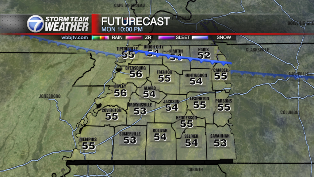
StormTracker 7 Max Radar:

We’ll return back to some drier weather ahead for Sunday. Temperatures want change much from yesterday but area expected to be a couple degrees cooler than yesterday. Skies will become mostly clear by late morning with high temperatures topping out around 80 degrees. Enjoy the dry day tomorrow as more showers and storms look to move in on Monday afternoon and again for parts of Tuesday afternoon.
OVERNIGHT:

A few scattered showers and storms will linger into the early morning hours. Lows around 60 with winds becoming more from the west northwest by morning.

SUNDAY:
Clearing skies through the morning hours and slightly cooler in the upper 50’s to low 60’s early and mostly sunny in the afternoon with highs around 78-80. Light northwest breezes.

NEXT WEEK:
Mostly cloudy, warm and humid weather will be hanging around for the beginning of next week. Also hanging around will be showers and weak storm chances. The winds will be a bit breezy and come out of the south or southwest. Highs will be in the upper 70s or lows 80s again for both Monday and Tuesday with lows only dropping into the upper 50s or low 60s. Rain showers and a few weak storms will be returning on Monday and expect mostly cloudy skies, severe storms are not expected on Monday. A few strong storms though could be possible Tuesday night into into the day on Wednesday but overall the severe weather threat still looks quite low. Another push for showers and storms will move through Wednesday night into Thursday morning before finally some drier weather returns. Chances for rain though appear to linger into the day again on Friday. Highs on Wednesday should be in the low to mid 80s and the weather is expected to be quite humid for most of the week with the southerly winds sticking around until Thursday. Once we get into the day on Thursday and a cold front finally passes, cooler and more mild weather will be returning. Highs on Thursday and Friday will only reach the mid 70s.
FINAL THOUGHT:
Spring has officially kicked off here in West Tennessee, and another night dropping into the 30s over the next week or two seems highly unlikely. We typically get our last freeze around the beginning of April and I think that was the case this year as well, feel free to start your gardening but keep an eye on them just in case we get a quick frost, but I wouldn’t expect it. There will be more chances for severe weather though as we get deeper into Spring. So you need to stay weather aware to changing weather patterns and monitor the forecasts closely. We got you covered in the WBBJ 7 Storm Team Weather Center as always.
For tips on preparing for the storms, click here. To download the WBBJ 7 Weather app, click here.
Brian Davis
Storm Team 7 Meteorologist
Twitter – @Brian7wbbj
Facebook – Briandaviswbbj
Email – Badavis@wbbjtv.com