Scattered Strong Storms Likely Today And Tonight
Weather Update: Monday, April 27 —

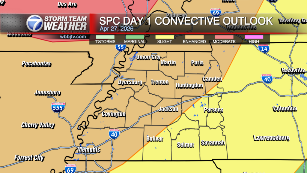
Good Morning West Tennessee. This morning we started off with some showers and thunderstorms in NW Tennessee. They were focused on a forward advancing warm front, the leading edge of a much more unstable air mass advecting north in response to surface low deepening near Kansas City, MO. Once the boundary has passes we will be in the warm sector. Temps will climb fairly quickly through the 70s through late morning and likely in the low 80s through lunchtime. I expect things to remain quiet as the expanding warm sector will also cap the whole area, preventing any new convection for a few hours. The fly in the ointment is now that we had rain and storm in NW Tennessee, those left outflow boundaries that are laying out over the northern third of the region. As temperature climbs, instability will grow over the Midsouth. Shear will start to increase by around 2:00 PM overspreading from NW to SE, most efficient by 3-5 PM. however a few CAM (convection allowing models) continue suggest there will be enough convergence somewhere along the Mississippi River by 2:00 PM CDT that a couple storm will break through and strengthen fairly rapidly through 3-4 PM. Most likely location, SE MO, Bootheel over into NW Tennessee. This is where the old boundary will likely be located based on what already happed this morning. Farther south, shear takes longer to arrive and there are no outflow boundaries. We’ll more likely be waiting on the main event/line after sunset for most of West Tennessee.

Storm Team Meteorologist
Moe Shamell
Facebook: www.facebook.com/mshamellwbbj
Twitter/X: @WBBJ7Moe
Instagram: @moeshamell