Tropical Depression Isaac: Friday Afternoon Update
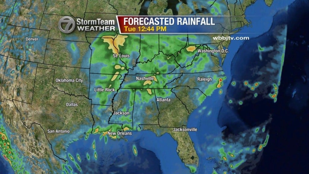
The picture to the right shows the forecasted rainfall from now until 96 hours (4 days) from now. Not a whole lot of rain is projected to accumulate in West Tennessee because chances are very scattered at best. With maximum sustained wind speeds now down to 25 mph Isaac is continuing to show significant signs of weakening, but is certainly not a threat worth disregarding. The potential of flash flooding and severe weather give us cause to continue to monitor the environment around this storm closely. Since it became downgraded to a Tropical Depression yesterday afternoon, Isaac is now moving NNW at 11 mph further into Arkansas and southern Missouri. Areas of Arkansas and southern Mississippi and southeastern Louisiana where in some spots as many as over 20″ of rain have fallen. Coastal flood warnings are in effect for sections of the Louisiana and Mississippi coastlines. Remnants of Isaac, are forecasted to move in a northerly direction before turning to the northeast later today, which would give West Tennessee a chance to see some more rainfall, but it would be scattered at best. The center of the storm will arrive in east Missouri by late tonight. Certain characteristics of the environment of this system are favorable for rotating storms and possibly isolated tornadoes. We don’t have as much instability in the atmosphere for these storms to be highly likely, but with the possibility of seeing some partly sunny skies today, that could change the instability of the atmosphere and the chances for severe weather could increase. Stay with the VIPIR 7 Storm Team for more updates on 7 Eyewitness News Good Morning West Tennessee on both ABC 7 and CBS 7.


