Significant Storm Threat Friday!! Large Tornadoes Possible!
Thursday Night Forecast Update
Thursday Night Forecast Update for March 30th:
A concerning storm set up will be in place across West Tennessee Friday evening. This is the most concerning storm set up since I have been the chief meteorologist at WBBJ. Please have a plan in place and stay weather aware as the storms move into our area. For the latest forecast information click the link below.
Check out the latest Facebook Live with Chief Meteorologist Joel Barnes

A significant storm threat will impact West Tennessee Friday evening between 5PM and 1AM Friday night. All severe weather modes including large, long tracked tornadoes will be possible. We recommend you stay inside Friday night and monitor the potential life threatening storms. Areas from West Jackson to the Mississippi River are under a moderate (4/5) severe weather threat for tornadoes and extreme straight line winds. We will have a full weather report and all the latest information on the storm threat coming up here.

NWS: CONFIRMS TORNADO AND STRAIGHT LINE WINDS FROM LAST FRIDAY:
The National Weather Service wrapped up their tornado survey damage on Monday in Mississippi from Friday night and made their way into West Tennessee Tuesday. They confirmed an EF-1 Tornado in Haywood County (near Hillville).
They also discovered straight line winds up to 85 MPH in Carroll County in southwestern Huntingdon and more straight line winds damage in Bruceton. 85 MPH winds is a borderline EF1 Tornado wind speeds.

TONIGHT:
Thursday started out a bit chilly with morning lows starting in the upper 30s. A nice warm up came during the afternoon and highs made it back into the 70s. Mostly sunny skies dominated Thursday and and the winds started to come out of the southeast as a warm front lifted through the Mid South. Thursday night the humidity will increase under the warm front and overnight lows will only fall down to the mid to upper 50s. Some isolated weak storms and rain showers will be possible but we are not expecting severe weather tonight.

FRIDAY:
The next chance for severe weather and possible tornadic activity will be here on Friday. The showers and storm activity early in the day will not be severe but by 5pm, some bigger storms are expected to move through. The storm prediction center already has a large area of West Tennessee under an enhanced risk (4/5) and an upgrade to a 5 cannot be ruled out.

The greatest threat starts west of the Mississippi River and the storms will move to the east across West Tennessee. The least concerning area as of now appears to be along the Tennessee River and heading towards Nashville but all of our viewing area will be impacted by the these storms late Friday. Highs on Friday will reach the mid 70s into the evening before the main event shows up.

The winds will be breezy and come out of south all day before changing to the northwest behind the front by sunrise Saturday. Friday night lows will fall down to the low to mid 50s. Please stay weather aware late Friday as some powerful storms will be likely with this system. We could see a widespread 1-2″ of rain with some locations getting up to 3″ before the storms clear out Friday night.

THE WEEKEND:
Just like the previous weekend we are expecting mostly sunny skies. Saturday will start out in the low to mid 50s and warm up to the mid 60s in the afternoon. Just like last weekend, Sunday will be a bit warmer with highs making it back up to around 70°. Sunday morning will be a bit chilly behind the front and temperatures will drop down to around 40°. Sunday night the winds will be back out of the southeast keeping us warm with next Monday morning lows will be in the mid 50s again.
NEXT WEEK:
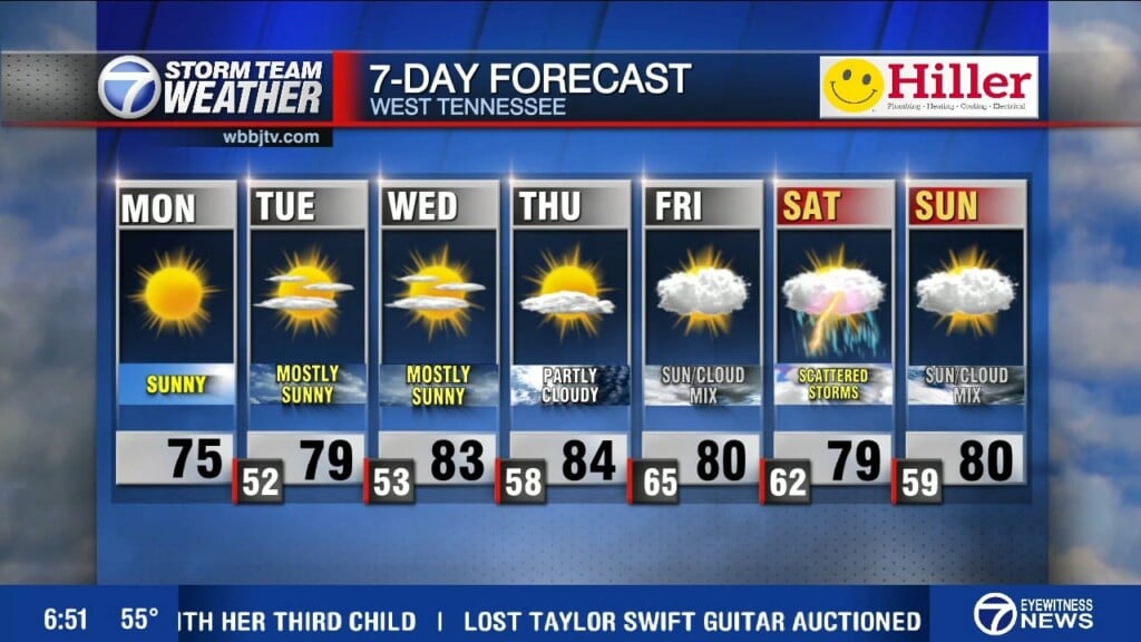
We are expecting an above normal temperature most of next week with highs in the mid 70s on Monday, low 80s on Tuesday and mid 70s again on Wednesday. We have not hit 80° this year in Jackson, but we could on Tuesday. More rain showers and storms are also expected off and on next week including some chances for some severe weather… we are getting into that time of the year unfortunately. The winds will be out of the south the start the week and overnight lows will fall to the mid 60s in the mornings.
FINAL THOUGHT:
After a very warm month of February, March started out to be the exact opposite and being below normal. The next chance for rain and storms is coming on Friday night, no winter storms are currently in the forecast but we will likely see some frost tonight. There is a 50/50 chance this will be our last freeze chance of the Spring. You need to stay weather aware to changing weather patterns and monitor the forecasts closely. We got you covered in the WBBJ 7 Storm Team Weather Center as always.

For tips on preparing for the storms, click here. To download the WBBJ 7 Weather app, click here.
Storm Team Chief Meteorologist
Joel Barnes
Facebook: @JoelBarnesWeather
Twitter: @JoelBarnes13
Instagram: @joelbarnes13


