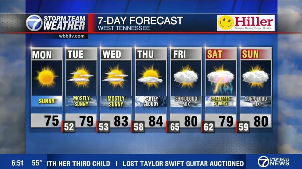
A Dry Stretch Of Weather All Week
Weather Update – 11:20 p.m. – Sunday, October 4th –
After some variable cloud cover this afternoon, we are clearing out nicely this evening. With dew points in the 50s and 40s , the dry air mass and clear skies will allow us to cool down even more tonight, compared to the low 50s we saw Sunday morning. Morning lows on Monday could drop into the upper 30s in some spots briefly.
A cold front moved through this afternoon and brought breezy conditions. Expect it to be much calmer tonight. With cooler conditions behind the front highs will stay in the upper 60s Monday afternoon. Winds will eventually begin to shift out of the south later into the week allowing for temperatures to warm back to average, slightly above average by mid-week.
A ridge of high pressure will build in the area, which will in return keep us dry for most of the week. Even the chance for rain will be low going into next weekend. The weather conditions later this week into early next week could change depending on influence from the tropics.
Potential Tropical Cyclone Twenty Six has formed over the central Caribbean and could be Tropical Storm Delta as early as Monday. This will be the system to watch for, as models have it showing making potential landfall somewhere in the central Gulf States by the end of the week. We’ll watch to see what impacts we can expect from this system all week, so stay tuned to WBBJ 7 Eyewitness News for the hour-by-hour forecast, and for more updates keep up with Storm Team Weather online too.
Corallys Ortiz
Storm Team 7 Meteorologist
Twitter – @WBBJ7Corallys
Facebook – facebook.com/corallystv
Email – cortiz@wbbjtv.com


