Two Rounds of Storms Expected Before the Cold Returns for the New Year!
WBBJ 7 Forecast Update
WBBJ 7 Forecast Update:
Two rounds of storms are in the forecast for West Tennessee through the weekend. The first chance is coming late tonight and sticking around into Friday morning. The next round could be more intense coming in on Saturday afternoon/evening and should move out by sunrise Sunday morning. The next cold front will be coming early Tuesday and that will bring a freeze back for the first week of 2025! Catch the latest on the storms and incoming cold right here.

THIS WEEK:
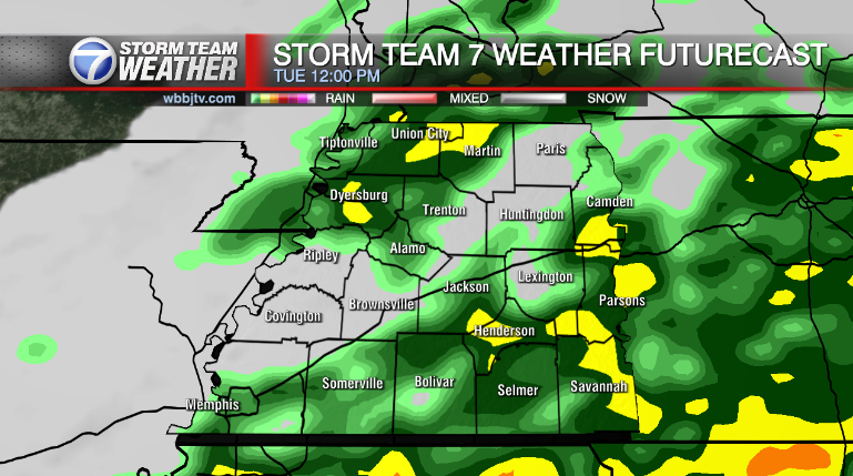
Thunderstorms and heavy rain showers will be returning Thursday night and becoming intense at times overnight on Friday morning. Thunder, lightning, brief heavy rain and 30-40 MPH wind gusts will be possible overnight. The storms will likely stay below severe criteria but we will be watching them closely tonight as they move through. Although we are not expecting them in West Tennessee, this storm system was producing tornadoes earlier on Thursday in Deep East Texas. The rain will move in around 10pm into West Tennessee and clear out for most before noon on Friday.

Highs on Friday will reach the mid 60s and tonight’s low will drop down into the low 50s. The system is coming up from the south so we are not expecting a drop in temperatures as it slides by on Friday. Friday night lows will only fall to the mid 50s as gusty southerly winds up under a warm front will keep things warm and humid. But that warm and unstable atmosphere will fuel another round of storms on Saturday across the Mid South. We are not expecting much of the sun on Friday but it will look to return in the middle of next week and possible for a few hours on Sunday.

THE WEEKEND:
The storm system that will produce the rain and storms Friday morning will lift straight to the north and another low pressure system and warm front connecting to the first system will move through late Saturday as well. Under that warm front, a humid and unstable set up will allow another round of heavy rain and storms to develop with it. We are currently under a marginal risk (1/5) in West Tennessee but we could be upgraded to a slight risk (2/5) before the event. Areas to our south in Mississippi and Alabama are already under an enhanced (3/5) risk for Saturday’s event. If you have travel plans to the south this weekend, you need to be cautious on Saturday and travel early in the morning or late at night to avoid the potentially dangerous weather. The system should move out by sunrise Sunday morning.

Like the system back on Friday, this one is also coming up from the south. Temperatures will not drop off much at all on Sunday and we should still hit the low 60s. Highs on Saturday will reach the mid 60s which is warm enough for severe weather this time of the year. Saturday night lows will drop down to around 50° and Sunday night lows will fall into the mid 40s if the skies clear out a bit. The winds are forecast to come out of the southeast on Saturday but turn to the west on Sunday as the system clears out. Saturday will be cloudy but we could see the sun peak out during the afternoon on Sunday.

NEXT WEEK:
The next actual cold front to impact West Tennessee is coming by Monday night or Tuesday morning. That system looks mostly dry but a quick light shower could move through Monday night or early in the day on Tuesday. Highs on Monday will reach the mid 60s, but fall to the mid 50s on Tuesday and Mid 40s for New Year’s Day. New Year’s Eve night will drop to the mid 30s but upper 20s look likely Thursday morning. We will see some clouds on Monday but mostly sunny skies will look to return to kick off the new year. The winds will come out of the southeast on Monday, the west on Tuesday and northwest for Wednesday and Thursday. Next week looks mostly dry, but cold as of now!

Storm Team Chief Meteorologist
Joel Barnes
Facebook: @JoelBarnesWeather
Twitter: @JoelBarnes13
Instagram: @joelbarnes13


