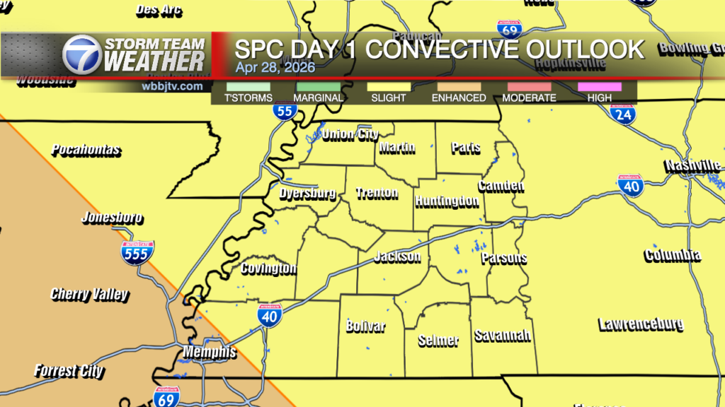
Brief Lull Today, Scattered Strong Storms Likely This Afternoon
Weather Update: Tuesday, April 28 —
Good Morning West Tennessee. We’ve finally entered the expected lull in the action. In fact, most of the clouds have even dispersed this morning. That is of course thanks to the departed mid level wave air is sinking towards the surface and warming up thus clouds cleared for now. A surface cold front is laying across the Western Kentucky Parkway through SE Missouri, It will make a modest attempt to start ushering in the cooler/drier continental air from the Central Plains. It will however be stopped by the new wave dropping from the Rockies into the Plains.

A new surface low is already redeveloping along the frontal zone/Red River Valley and will quickly race NE through mid to late afternoon .

This will push moisture back to the north at the surface across the Midsouth, With daytime heating instability expected to grow significantly. 45-50 Knot Shear will spread West to East,, but also advect very cold temperatures aloft creating very steep lapse rates this afternoon. 12z HRRR suggest lapse rates 7.9°C/km very stout for this area, this means large to giant hail will be a bit problem in storms, and possibly one of the primary hazards along with 70+mph wind gusts.
 While the threat isn’t particularly high today, couple tornadoes cannot be ruled out. In fact, the hatched mars mean those tornadoes could be EF2 or stronger

Storm Team Meteorologist
Moe Shamell
Facebook: www.facebook.com/mshamellwbbj
Twitter/X: @WBBJ7Moe
Instagram: @moeshamell